Showing posts with label Pacific Crest Trail. Show all posts

Tuesday, December 16, 2014

Pacific Crest Trail

      I started off the Pacific Crest Trail hot. Like a bat out of hell. Like a ten year old sprinting the first 100 meters of a road race. And it was hot. About 90 degrees in the SoCal sun. I charged through the first 20 miles in 7 hours carrying a pack heavy with a week's worth of food. I passed a lot of people, most of whom woke up that morning with the goal of hiking to Canada. Some of them, myself included, went to sleep that night second-guessing our lofty ambitions.

     The trail starts near the Mexican-American border, about 30 feet away from a corrugated metal fence that marked the boundary. I wondered how it would look if the fence were made of adobe instead of metal sheets fitted together. I envisioned a Great Wall of the Southwest. There was a border patrol cop near the trailhead. I asked him if anyone ever tried escaping from the US into Mexico. He scoffed and shook his head no. My friend Kaison drove me to the start. He seemed eager to join me, but he reluctantly got back into his mini-van, a fashionable ride for the recent college grad, and rolled back to San Diego where he works at an educational start-up founded by Williams students; Learn2Earn.
The Border

The Pacific Crest Trail (PCT) starts at a fence and ends in a park. On that first day, I began my walk away from that lonely fence in the desert towards that park in the distant northern forest. I heard many helicopters while I was near the border, either searching for illegal immigrants or stranded backpackers. A lot of the hikers in that first section were not in great shape and struggled with the heat and terrain. Most try to hike 20 miles the first day to reach Lake Morena, where there is a campground with water and hot showers. But, many did not make it there. There was a water cache filled with gallons of Arrowhead water, stocked by benevolent "trail angels," located about 5 miles before Morena in the hot Hauser canyon. Many weary hikers stopped here to spend the night. These water caches are vital in the opening desert sections where water is scarce.
The Trail Monument and Me
The first day is definitely the most dangerous of the whole trip. People don't know what they are getting themselves into. Even I, a seasoned backpacker, underestimated how hard 20 miles can be with a heavy pack and a hot desert sun.  A couple days after I hiked into Morena, a 19 year old died, only a mile away from Morena. Apparently, many hikers passed him, but he motioned for them to keep moving. He was dehydrated and called his dad--you'd be surprised at the places you get cell service--who called 911. They choppered in, but not in time to save his life. This happened right before kickoff, a big party in the Lake Morena campground timed to coincide with the start of many people's hikes. The next night, a freak rainstorm blew over many people's tents and drenched belongings both in Lake Morena and points further up the trail. It was an auspicious start to the 2014 PCT season.
SoCal Desert
The next day I hiked up from Morena to Mount Laguna where winds ripped through the big pines. My feet ached and I counted the miles which dragged along with my feet. Halfway up Mount Laguna, tired, sore, thirsty, I heaved my pack down on the trail, in between the cacti and low desert trees. I heard a rattle and looked down at a snake not five feet away from my feet. I backed up and walked a wide "C" around the rattler, before continuing my way to Mount Laguna. I set up camp at a time that I thought late, around 7 o'clock, having covered 22 slow miles, less than the 30-mile-a-day aspirations that I entertained from the comfort of my home. About thirty minutes later, an older guy strolled in, talkative, cheery, in contrast to my beleaguered self. He introduced himself as Rags.
Gnarly Blister eww!
 Perhaps the most immediate characteristic that distinguishes a thru-hiker from your normal backpacker, apart from the stench and mangy facial hair, is the name. Trail names are a time honored tradition on the PCT and other long trails that snake through America. At this point, on day 2, I didn't have one yet, and to be honest I was a bit circumspect about the whole thing. Some sounded a little forced to me. I could understand a truly awesome trail name that accurately nailed down a certain aspect of a thru-hiker's personality, but the ubiquity of the practice lessened the impact of each name. I didn't want to be forced into a name. I didn't feel the necessity to separate my trail self from my "civilian" self. But, for some people, their trail name becomes more meaningful than their real name. It is a name that while given to you by someone else, you can either use or discard. For some people their trail identity subsumes their real identity. 
Mount Laguna
Rags, who I came to know through miles of hiking together, was a recent retiree, a Vietnam Vet with grisly gunshot and shrapnel wounds in his lower leg. Despite this, he puts in impressive miles while maintaining a stolid disposition. After the first day, hiking up Hauser Canyon, he began spitting up blood and flew back to Seattle before restarting the trail a week later. He is a a student of the ultralight philosophy, going so far as to cut all the tags off his clothing. He, like many others in Southern California, travels without a tent, but has a room dedicated to outdoor equipment at home, so getting one is just a phone call away.

The next day, it became clear that thirty miles a day was an arm chair fantasy and twice I nearly broke down. I called my dad from a picnic area near an asphalt road, overwhelmed with the pain and enormity of my task which was just sinking in. The arrival of Rags boosted my spirits and I continued up a dirt road to a water tank where I lounged with other thru-hikers. 
     

The trail often hugged the mountainsides, weaving in and out of dried arroyos, those deserted creek beds that only flow during rainstorms. So, even if I could see the trail a mile away, it could take three miles of walking along the steep ridge walls to reach that point. Camping is also sparse on these steep slopes, and the trail angles downhill, which can cause knee pain and other problems. 
The trail stays true to its name. The Pacific Crest Trail, emphasis on the Crest, seeks the spiny peaks and highest ridges on its way from Mexico to Canada.
Eagle Rock
After the relentless ridge that was the San Felipe hills, I chilled for a while at Barrel Springs, a cistern filled with cold spring water and equally cold Cokes and Beers. I was careful to avoid the Poison Oak that lingered in the shade of the thirsty oaks. From here the trail took on a greener aspect, a departure from the red sand that characterized the first 100 miles. I walked on mellow hills and descended into the Serengeti-like flats near Warner Springs, where I spied a lone tree that stood out from the grassland like an Acacia Tree in Kenya. A bit farther along sandy trails loomed Eagle Rock, perched on the top of a rise. You don't have to look closely at the picture above to see an eagle, wings outstretched, protecting her nest eggs. The resemblance was so uncanny I wondered if Indians had chiseled away at the rock to create such a likeness.
       
Early Morning Clouds

From Eagle Rock, I continued onto Idyllwild. Cold rain and fierce winds buffeted my tent in Warner Springs, but a cup of coffee and a meal of eggs, biscuits, and sausage warmed me up after a cold night. I charged over green mountains, the promise of Idyllwild and the trail famous Paradise Cafe burger fueling my ambition. An "easy" 18 miles into the trailer compound of Hiker Mike's, where I stayed the night, then 26 miles the next day, a marathon down from the windy hills to Paradise Cafe and a juicy burger. From here I hitched into Idyllwild. I stood on the side of Highway 74, thumb extended uncertainly, and my first attempt at hitching proved successful within minutes. The "Colonel," an authority on magneticss, and his wife drove me into Idyllwild, past the wildfire that ravaged the PCT a couple years ago and ruined the trail just north of the cafe. 

In Idyllwild, I secured a inn room, and reflected on my accomplishment, 152 miles in 7 days. I felt good, but my feet did not. The next day I took four trips to the grocery store, agonizing over each food choice. My next stop was Big Bear, 100 miles away. All that sweat and pain, and now I had to do it again! I stayed in my room, watched the NBA Playoffs and the Donald Sterling saga unfold. One 'zero'-- a day with no trail miles--turned into two. Uncertainty and despair swirled within. In retrospect, I should have spent more time in the campground, with some of the other hikers, but I felt like my mood would bring them down. 


They say yawning is contagious.
I woke up feeling better, and gathering my energy, charged up San Jacincto Peak, the second highest mountain in SoCal after San Gorgonio. Descending was not as fun. Over ten miles of switchbacks twisted down almost ten thousand vertical feet, but at least I was able to admire the flanks of the formidable peak as I threaded my way to Ziggy and the Bear's. Ziggy and the Bear are trail angels who host PCT hikers in their backyard and treat them to foot baths, free showers, and a Burger King run at 1:00. I power-walked across the valley floor to get there in time for fast food. Apparently, Ziggy and the Bear bought their house in Cabazon specifically because of its proximity to the trail, which makes sense because there isn't that much else to Cabazon. It is a small outpost huddled against the hillside, across from the interstate and dwarfed by tall spinning windmills.


San Jacincto Peak
I hiked into the night from Ziggy's. The trail skirted windmills and free-range pastures before curving around to Mission Creek, a cool stream that nourished large Cottonwoods and other plants along her banks; a green line carved in the desert valley floor. It was refreshing to encounter water after so many days without. Little Mission Creek was like the Mississippi to me, only more beautiful because of its refusal to submit to the arid desert. It cascaded down rocks in little waterfalls and pooled in sandy shallows perfect for foot baths. I took a nap, ate lunch, relaxed, ate dinner beside its banks. I found a nice walking stick, a charred branch from a burnt bush. It was remarkably sturdy despite its light weight and one end formed a perfect handle, especially when I wrapped my handkerchief around the notch. I developed a strange affinity for the thing and it was my companion for the next 100 miles.
My Sturdy Companion
I slowed my pace, just as others increased theirs, and I hiked along Mission Creek with many others, who like me, savored this oasis in the desert. Mission Creek took us to Big Bear Hostel, a laid-back house claimed by hikers for the PCT. An all-you-can eat Chinese Buffet and a large meal at a Sports Bar provided nourishment for my next section. I only spent one night in Big Bear, careful not to repeat the mistakes I made in Idyllwild.
Foot Bath at Mission Creek

 The next day, I followed the hills that skirted Big Bear Lake to the headwaters of another stream, Deep Creek, which lived up to its name. It cleaved the rocks and gathered in dark pools before continuing down the valley. I hiked into the night, eager to reach 30 miles for the first time. But, despite my effort, I was only able to hike three miles over the last three hours, and at 11:00, I picked a spot near the trail and was nearly asleep before unfolding my sleeping pad. Not ten minutes later, I awoke out of a light sleep to a flurry of movement and a noise that registered somewhere between a scream and a roar. I looked over through the darkness to Apache, a fellow thru-hiker who had joined me in my late night push. 
"Dude, was that a mountain lion?" I asked.
"I think so" he replied. After a few minutes of tense silence, Apache put up his tent, a sturdy barrier between man and beast.
I was so tired, I didn't bother to follow suit. Instead I lingered in half-sleep with my walking stick in immediate arm's reach to my right, my small pocket knife near my head. I remained in this position, drifting in and out of sleep until early morning light filtered through the darkness and I relaxed into sleep. 
Apache is an interesting character. Last year, near the start, he nearly died. He wandered off trail and survived three days without water, subsisting on cactus flesh, before finding his way back to the trail where he passed out. Someone woke him and he recovered for two weeks at home before starting again. He blamed his hiking boots for his near death experience and now favors the open-air Teva sandal. Last year, he met Anish, the women who broke the PCT speed record. She hiked the trail in under 60 days, averaging 44 miles a day. Apache met her in Tuolumne Meadows in the High Sierras, and described her as shrunken and shriveled, a raisin in the sun. She survived on goo mixtures that she would squeeze into her mouth.
Apache hiked most of the trail last year only to fall 150 miles short of Manning Park and the Canadian border. Apparently he spent too much time in town along the way, and when the choice came to buy snowshoes or a ticket home, he opted for the latter. He hikes wearing a wide-brimmed bowler hat studded with feathers he has accumulated along the way, hence the badass name "Apache".
Deep Creek

     I hiked onto Deep Creek Hot Springs where I relaxed in the restorative waters and saw naked people of both sexes and every body type. There were a few woman, but even I, a 24 year-old manboy, was more concerned with the nourishing water than the female form. Maslow's pyramid proves especially true in the back country; food, water and comfort take priority over sexual desire.
I didn't follow suit and kept my shorts on when I joined the mix of thru-hikers and revelers in the springs. The water eased my sores. At this point, my body ached. My feet were sore and blistered and the areas around my shoulders were red from where backpack dug into flesh. It was an improperly sized pack, one salvaged from my basement, and along with digging into my shoulders, it cut into my hips, sending pins and needles down my lower back and butt. Wolf, a thru-hiker from Denmark, remarked on my red shoulders. I was a bit self-conscious, but I knew it was time for a new pack. Luckily, I was scheduled to meet my Uncle Henry in two days at Wrightwood. 
Mile Marker 300
I left Deep Creek and walked through desert past the dammed Silverwood Lake, which was beautiful despite its artificiality, and finally underneath the Golden Arches and into the sanctum of McDonalds. I spent $20 and ate more of Rags' food when he joined me. Next time, I'll stick to the dollar menu. We spent that night sandwiched between a highway and a railroad, not the most pristine of backcountry campgrounds. From there, 27 more miles up some more mountains, a 5,000 foot ascent narrated by Ira Glass of This American Life. I was careful to avoid the nefarious Poodle Dog Bush, a plant we had all been warned about down the trail. I walked underneath large conifers and through grassy ski runs, down to a forgotten highway with no cell service. 
Map of the PCT until Wrightwood


Luckily, a pickup dropped off another thru-hiker and I jumped in the back down to Wrightwood, a small mountain town two hours from LA. My Uncle Henry picked me up and shuttled me down to LA. In LA, I walked the Venice Boardwalk and picked up some gear, a new stove, the efficient, light JetBoil, an Osprey Pack, a huge upgrade, and two trekking poles. I spent three days in LA, and like my long stay in Idyllwild, I found it hard to get back on trail. I had stashed my walking stick earlier and I picked it up one last time before placing it carefully back among the bushes. Trekking poles stabbing the dirt, I marched into the fading light, half man, half machine. 360 miles down, only 2,300 to go. 

    
The Trail Continues On

Monday, December 15, 2014

Highs and Lows

It was the best of times, it was the worst of times. It was the age of wisdom, it was the age of foolishness. It was the season of light, it was the season of darkness. It was the spring of hope, it was the winter of despair. We had everything before us, we had nothing before us.
The intro to A Tale of Two Cities turns out to be an accurate description of my experience on the Pacific Crest Trail, although I suppose it could be fairly applied to any other arduous adventure.
Pointing north on the top of Mount Whitney
The best of times were often followed quite immediately by the worst of times, and the worst of times often precipitated the best of times. In the high Sierras, around mile 870, I was low on food. That day, I hiked 35 miles over two snowy mountain passes, and worse, down two snowy mountain passes, my legs sinking knee-deep with each step. For this reason, it is best to tackle these snowfields either in the morning or late evening, when the sun is softer and the snow is harder. At 9 PM, in the darkness, I crossed Bear Creek, a grisly crossing as described by the guidebook, but this year was mercifully low on snow, and the water barely touched my knee. Still, the water was cold, and I was relieved to take off my socks and partially dry them next a small fire I constructed using old maps as kindling. I fell asleep around 10, the warmest I'd been in days, safe below 10,000 feet. There was no frost when I awoke in the morning, the water in my Nalgene bottle, harvested from the last snow-fed creek remained unfrozen. But, my watch showed a time of 11:00 AM, and though it was bright, I was sure I had not slept that long. I tried to check my phone, but it ran out of battery as soon as I turned it on.

Yosemite National Park looking back on the Sierras
I still planned on hiking another 36 miles to Red’s Meadow before getting resupplying. I had two Mountain House meals left and a tortilla. I figured I would eat lightly and arrive at Red’s the next morning, hungry, but not famished. Well, maybe famished, but at least assured of a hot meal within the near future. Unsure of the time, I started to hike, on stiff joints and cracked feet. I thought I had left Bear Creek behind, but I forgot the North Fork, and then another creek, small but swift, and I was unable to string enough rocks together for a dry crossing. The water was cold, I was uncomfortable. I moaned, an outburst resulting more from my emotional distress than any physical pain. I sat down next to the trail, ate my last tortilla and shut my eyes. A blue jay squawked at me from its perch on a pine tree. Annoying bird. I threw a rock in its direction, not aiming to connect, just to startle. It remained unconcerned. The birds out here rarely sang a melodious tune and the Stellar Blue Jay was the worst offender.
The trail in the High Sierras

There was nothing to do, except to walk some more, up along a ridge and then down an interminable series of switchbacks. I passed a couple makeshift signs along the way, each directing me to VVR, the Vermilion Valley Resort, which had just opened to hikers and promised a hot meal, a hot shower, and ample food for resupply. I continued on, still determined to stick to my original plan, which was to hike the entire stretch of the Sierras with no resupply; a distance over 200 miles, 220 if I counted my side trip up Mount Whitney. Plus, VVR was 6 miles off trail and I disdained the idea of hiking extra miles. I walked through a grove of birch trees with initials and hiker names carved into the bark, sometimes encircled by a heart. I crossed a bridge, thankfully, and the last sign encouraging me towards VVR. I continued on, through another stream and then up towards Silver Pass, the last obstacle between me and Red’s Meadow. I kept debating whether I should value the experience over the physical challenge and the two battled for supremacy in my mind. Of course, the physical challenge was part of the experience, but when I thought of the experience, I considered it to be more about the people and the cool places off trail in the backwoods of America.
Thousand Island Lake in the Ansel Adams Wilderness 

My mind was more exhausted than my body. My pace was as slow as the glaciers that once carved these valleys. I couldn't take it any more. I turned around, back downhill, towards VVR. My pace accelerated, a mountain stream skipping down the rocks. Food! Beer! Ice Cream! Little Debbie Snack Treats. A 400 calorie chocolate chip muffin. An IPA, on the house. A large chicken Alfredo pasta, a salad, and a blueberry pie with ice cream that I could not finish. NotAChance and Mac, two other hikers, happily took it off my plate. My mind cleared. I fixed my watch with a simple click of a button. I weighed myself, 147 the lightest I had been since I ran cross country in high school. Now, I was hiking cross country, so it was fitting that my weight corresponded with the streamlined days of my adolescence. 
Skinny Selfie

The next day, I hiked to Iva Bell Hot Springs, a short way off trail, in the company of some other hikers I had met along the way. My solitude had been shattered. I had no immediate need for food, and in some ways, I wished I had continued on, just to push the edge of that physical and mental limit to see what I might find out about myself when I looked back in.
The next day in Mammoth, after a morning soak in Iva Bell hot spring, I gorged myself, walking from restaurant to restaurant as I made my way back to the hostel. 
Mating ritual or fight to the death?

Many people would consider it foolish to hike 25-30 miles a day, every day, and often I felt the same, especially in Northern California, after the majestic snowy heights of the Sierras. Up here, the heat seemed trapped in the pine trees and only places of succor were the small springs that flowed out of the steep ridge sides. There were no lakes to jump in, only rivers that gouged deep gorges into the rugged forests.  My motivation had peaked with the altitude, and throughout Northern California I wondered if I really wanted to finish the trail. They call this feeling the Northern Californian Blues and I heard that about 20% of people quit in this stretch.
The half-way point in Northern California, just south of Lassen National Park

I made it to Castella, a small outpost with a post office and a gas station, next to Interstate 5 and the railroad. The temperature hovered north of 100 degrees. I sat down on a picnic table and watched women in short shorts fill up their gas tanks. Quite a vision after 70 days on trail. Soon, a whole bevy of other hikers joined me on the picnic table and I was able to hitch a ride along with them to a hotel in Dunsmuir. We watched the US lose to Belgium in the World Cup. One hiker, Milestone, got a little too drunk and puked outside the sports bar. They hitched back to the trail, while I stayed in town, reluctant to resume my trek. My mind wrestled with indecision, and with each day of inaction, I spent more money and moved farther away from the trail. I slept underneath a bridge and in a dismal one room train station next to a guy with a motorized scooter who liked to count the number of cars in each Southern Pacific freight train. I took an Amtrak up to Klamath Falls and watched the Fourth of July parade down a Main Street which was otherwise empty. I watched more World Cup Games and ate dinner twice at a brewery with amazingly attractive waitresses, but somehow I was assigned the least spectacular one both times. Maybe it was my patchwork beard. I read a book called the Tao of Pooh, and I tried to just be; an uncarved block, a thing with potential. I tried to recognize and understand my inner nature. Decisions would make themselves. I decided to fly back home, and then, already on the Amtrak Train up to Eugene Oregon, my inner nature felt uneasy, and I decided to hike some more.

Fourth of July in Klamath Falls, Oregon


After two days in Eugene, I took a train back down to Dunsmuir. I arrived at 2:00 AM, and because the only road connecting Dunsmuir to Castella was the highway, I walked down the railroad tracks in the dark. Along the way, I heard a noise that sounded like an unholy mixture between a ravenous stray dog and a scavenging bird. I took off my backpack, and like an actor in a horror movie, fumbled to unloosen my trekking poles before brandishing them at this unseen devil. “I’m leaving. I’m leaving. Just passing by.” I spoke in a voice that resonated from a depth unfamiliar to me.  I walked away briskly, into the moonless night. A freight train rumbled past, covering my exit. I took large steps from railroad tie to railroad tie until I reached a paved road that marked the boundary of Castella. On a dirt parking lot nearby, I unrolled my sleeping bag. The next day, I hiked.
The path (taken)

Friday, December 5, 2014

Reflection

Around mile 1100, I found a quiet spot off the side of the trail next to a lake and settled down for a late breakfast. Despite the constant desire for forward momentum, I determined to enjoy this well-earned respite. I had survived the gauntlet of the High Sierras; surmounted its icy, rock cathedrals and weaved my way down through the soft snowfields that clung to the ramparts. I had crossed the Tuolomne Meadows and its swarms of insatiable mosquitoes. The desert was long in my dust. I had emerged a mountain man, or so I fancied myself, forged in the crucible of that alpine altitude. My fingers twirled the hairs of my budding beard, yes still a little thin on the sides, but I was pleased with the growth. I leaned back against a rock and exhaled.
Hikers on Sonora Pass

Too often I worried about the miles ahead, still over 1500 to the border, another 45 to my next resupply. I wondered if I would make it. Did I have the right stuff? After all, I had decided to hike the trail on little more than a whim; barely a month passed from the time I first considered the thought to my first steps away from the Mexican border. Others had dreamed about this trail, their hike, for years, and spent more time planning  and researching than they would on the trail. I did not have the same initial investment, the same sunk cost. I was 24 years old, unemployed, unsure of myself, my direction in life, but at least on the trail I had a direction—north, and a goal—Canada. I pushed the future miles and concerns about my future out of my head. 
The Bridge of the Gods: Cascade Locks, Oregon

I supplemented my daily oatmeal with a cup of Folgers Instant coffee, a treat courtesy of Milestone, a fellow thru-hiker who was liberal with his food. Perhaps the coffee’s flavor had an inverse relationship to its effectiveness; it tasted terrible, but packed a punch. After limiting my coffee intake to town stops along the way, I had rediscovered an old sensitivity and the stuff surged through my body like a super-drug. I resumed hiking, at a faster clip than ever before. I entertained those cheery thoughts that occupy a mind when one is confident and assured of their forward progress. I barely noticed the scenery, high off my caffeine buzz, but, after about two hours, it seemed that the trail was skewing east. The sun was no longer behind me and upon closer inspection, the path seemed rougher and less defined than the well-trodden PCT. My phone was out of battery; earlier, the folks at Echo Lake turned a deaf ear to my requests for a spare electrical outlet, so I couldn’t check my HalfMile app to see if I was on trail.
Smedberg Lake after Tuolomne Meadows

I continued hiking, less assured than before, but still unwilling to acknowledge the fact that my caffeine-fueled powerwalk had accomplished the opposite effect and instead of making time, I had lost it. After another half hour of walking east, willing the trail to turn right, I admitted defeat and pulled out my paper maps, fearful of discovering just how lost I might be. It wasn’t too bad. I was near Phipps Pass. I had somehow missed the junction earlier and now appeared to be about 5 miles north of trail split. I didn’t want to retrace my steps, and looking at the contour lines, and remembering some route-finding techniques from an old NOLS course, I figured I could bushwhack back to the PCT. I welcomed the change to my routine, a brush with nature, a chance to experience the wild up close. I clambered over a small knoll and maneuvered down a scree slope that fed a rock-choked lake, and skirting the lake, I picked up a drainage that flowed to the west back to the PCT. I circled around a marsh and threaded through a pine forest careful to keep the stream within earshot if not my eyesight. I felt like Kit Carson, or Geronimo, just me, the wild, and my hi-tech backpacking gear. Progress was slow and not straightforward. I had to climb over logs, around cliffs, but I eventually met up with the trail, that thin slice of civilization on a large desolate wilderness. I ate an avocado, honey, salami, hummus tortilla (delicious) and waved to Milestone when he passed me.
Lake Aloha

I hadn’t lost too much time, but I didn’t have much time to lose. I was set to meet the Moffats on Saturday, in less than two days, and I was 45 miles away from Route 40 where they would pick me up. I accelerated, like a magnet to metal, the promise of food, shelter, shower solidifying into reality the closer I got to Donner Pass. Unlike the Donner Party, I would not starve. The Moffats' were more than hospitable. David Moffat graduated from St. Paul’s two years before my parents and met his wife Wendy at Brown. They are west-coast transplants but both seemed to have fully embraced the style. They were drawn to Truckee because of the mountains, the skiing, and the good people that enjoyed the mountains. David and Wendy both remarked that a special kind of people like and live near the mountains, a good people, humbled by the power and beauty of their surroundings.
At their mountain house, I ate lots of hot food, cereal (Honey Bunches of Oats), chocolate Ovaltine milk (just great) and I discovered that my interest in the FIFA World Cup was second to David's who is an absolute soccer fiend. Wendy even drove me across the border to REI in Reno, where I exchanged my backpack free of charge. And how did I repay their hospitality? By scratching up their Prius, a car so easy to handle that David claimed it could drive itself. I was so embarrassed, and still am. I admitted my mistake only later in a thank you/apology postcard. I really stretched the limits of the writing space, expunging my guilt.  

I wish I could tell you my hike was a journey of redemption, a triumph of the will, if you’ll pardon the expression. But, I didn’t find myself, or rediscover some insight hidden within the depths of my soul. It was awesome, it was like nothing else I’ve ever done, and I doubt I’ll ever do something like it again. I struggled, I survived. There were times of triumph and of absolute misery. I reached my apex with the trail, on the frozen heights of the sublime Sierras. Fattened from the Moffats and my food bender earlier in Mammoth, I never regained my earlier sleekness. I spent a lot of times in grocery stores wandering through the aisles, looking at the items in my cart, wondering, is this really all I’m going to eat for the next four days? If only I could take the store with me. In Washington, I took to sleeping with my food to protect it from the mice that seemed to infest every campsite, and in doing so violated every rule of bear safety and camping protocol. But, it was better than the alternative—holes in my food bag, little brown turds on my JetBoil cup. 
On the trail, I looked forward to towns, and what they offered; food, and comfort. But, I knew that each stop would be short and that the next night I'd be curled on my worn-out sleeping pad that did little to soften the roots and bumps of the hard ground, and inside the thin walls of my tent that did little to muffle the fearful sounds of the night. Terrifying sounds, the dive-bombing night-hawk that sounded like a super-sonic semi rumbling by my tent (see video below), the bleat and heavy hoof-steps of a deer (identified only after I worked up the courage to open my tent), the screech of a mountain lion down in Southern California, the unidentified noise of some mutant creature on the Southern Pacific railroad. I wondered if I was losing my mind. I wondered if I would lose my life. 

I don't have these same concerns now, I'm safe and warm in town, but I worry about other things. I am not a thru-hiker anymore. People don't offer me free food, rides into town, or marvel at the miles I've hiked. The thru-hiker hubris has faded and now I'm a normal person who did an incredible thing. And it's hard to be normal once you have felt exceptional. 

Monday, November 10, 2014

Riders on the Storm

I was asked two questions on the trail. The first was, “Where are you headed?” I answered with one word, “Canada,” in a voice that grew more confident the closer I got to the border. The follow up question could also be condensed into one word, “Why?”, though the asker was usually too polite to frame it so concisely. That was a tougher one for me to answer. Towards the end of the trail though, I had a lot of practice, and I answered something like; “I wanted to challenge myself and see if I succeed at something really difficult.” Which was true. And I succeeded.
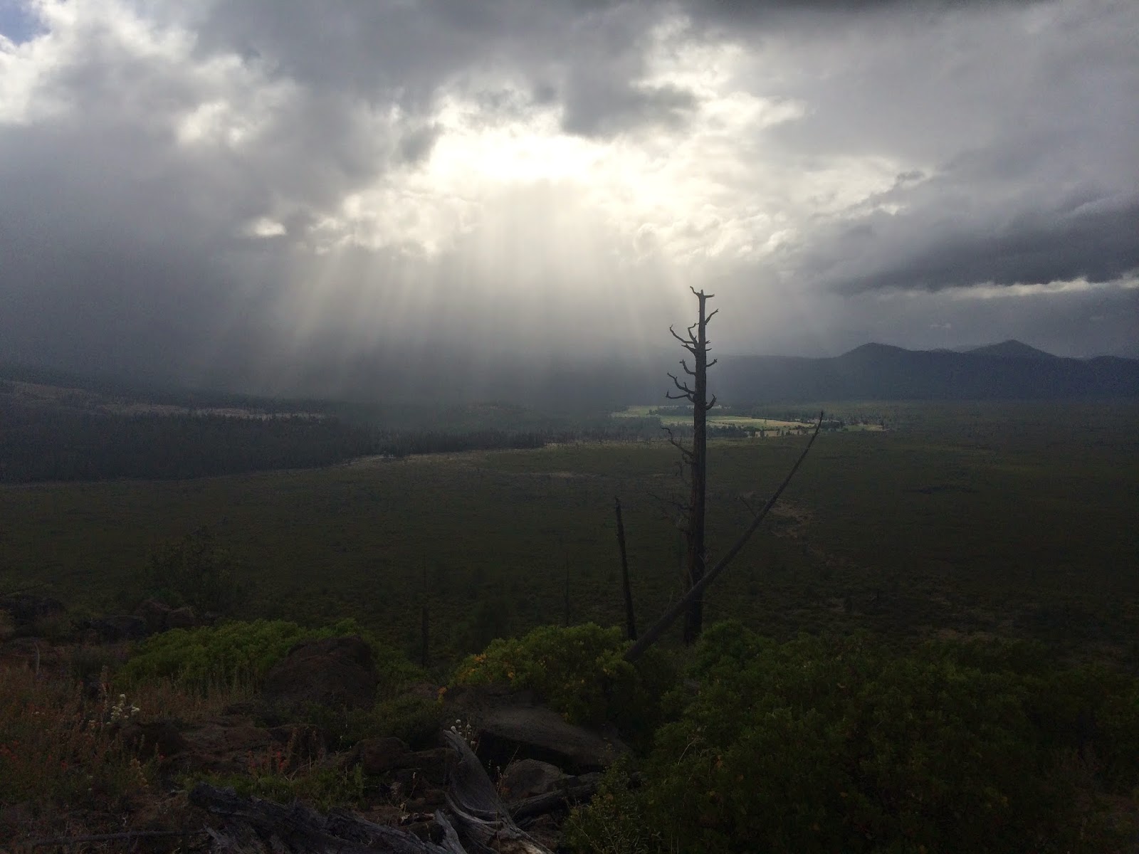
A rare cloudy day in Northern California
But, that wasn’t the whole answer. I also wanted to see the country, the lakes, the mountains, the trees. When I stopped in Northern California, the unseen sights ahead encouraged me to continue; Crater Lake, Mt. Hood, Rainier, Jefferson, the Northern Cascades, the Columbia River, the California Border, and most of all that glorious clear cut separating America from Canada, marking the end of my journey.


Crescent Lake and Diamond Peak, Oregon
The steep climb out of Castella reminded me how hard the trail could be. My newly adopted Zen approach could only sustain me so far, especially in the heat of the Northern California summer. I found solace in company along the way, hikers who shared my pain and a trail angel who shared her food and water. After two days back on trail, I covered 50 miles in 28 hours into Etna, appropriately named for the Sicilian volcano, a hot place in the shadow of the looming Mt. Shasta. I arrived just in time to watch the second half of the World Cup Final, a victory for the Germans. Etna was small, but the perfect size for a through-hiker, with a couple restaurants, a grocery store, and an award-winning brewery; a place made more navigable by the loaner bikes provided free of charge by the local hostel.

Mount Shasta
The next stop was Seiad Valley, an even smaller place, a diner, grocery store, and post office huddled together in one low-slung building near the Klamath River. On the walk in, the trail turned into a dirt road and I passed a number of rural compounds with creepy, strung-up dolls and hand-drawn signs that showed two askew Xs. At first, I thought the asymmetry was a result of crude penmanship, but I later learned that these Xs constituted the seal of the “State of Jefferson,” a succession movement entertained by some of the locals. Here, I 
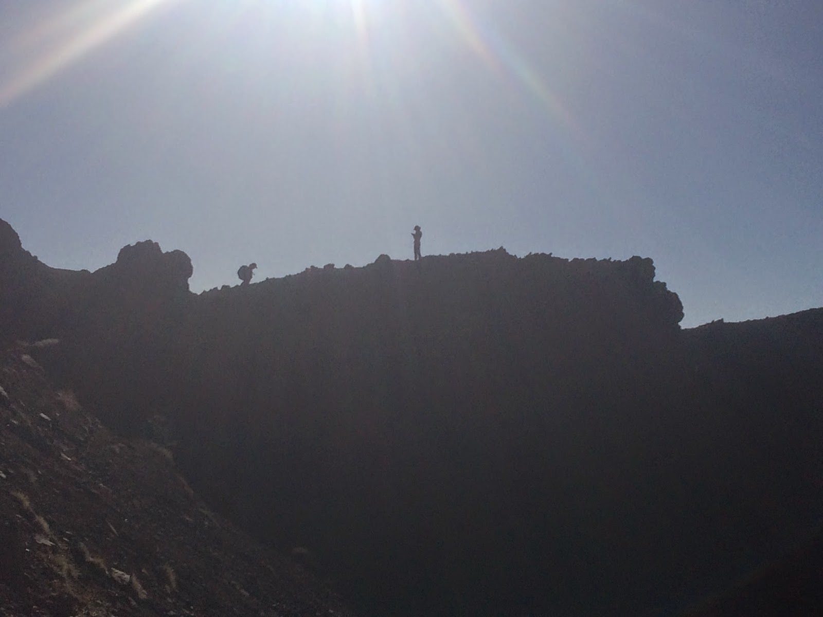
watched the thru-hiker Foxy attempt the famous pancake challenge. He made it halfway through the 5 pound stack.
Foxy struggling through his pancakes
I continued to hike north and finally reached the Californian Border. I perused the trail register, looking for the names of hikers before me, many of whom I knew. The next day, after the border crossing, a wave of depression hit me, and I struggled to hike into Ashland, now only 10 miles away. I tried to “Yogi,” or wrangle, a ride from two day hikers but they discerned my intention and accelerated to their nearby car. I sat in the dirt parking lot, despondent, ate Nutella and read Steinbeck’s The Pearl until a trail runner returned to his car and I was able to hitch with him into Ashland. He was a nice man and assured me that there was no shame in quitting now. I did not quit though.
The Oregon Border
In Ashland, my spirits were further bolstered by Snailtrainer, a 50 year old Englishman who fit the stereotype. He had a front tooth missing and a ribald sense of humor that often escaped detection due to his heavy use of the British vernacular. He carried the heaviest pack on trail, and extra equipment jangled off the back. Despite the added weight, he maintained a robust pace. I hiked with and near him for much of Oregon. On a particularly dreary stretch after the stunning Crater Lake, we reached a road and decided to hitch to a nearby resort that catered to RV campers. It proved to be a wise choice. We shared an east-coast caliber pizza and Snailtrainer was thrilled that the place served “jugs” of beer, as opposed to the standard English pint.
Snailtrainer
After Crater Lake, the trail passed by a string of lakes for about 60 miles, the most I’d seen since the High Sierras. During a rain storm, I saw a bald eagle swooping over the lower Rosary Lake. From here, the trail headed to and then snaked around the Three Sisters, a trio of volcanos that dominate the Central Oregon skyline. 1,000 miles after the Sierras it felt good to again be in an alpine zone, with its clear springs (I could see the source) and colorful wildflowers. I genuinely felt uplifted by the scenery. After scaling a steep lava field, I reached a high alpine zone and looked back to see the evening light strafing through a low cloud cover.  
Approach to South Sister
After the Sisters, I resupplied at Big Lake, an incredibly hospitable Christian Youth Camp. The trail skirted Mount Jefferson and then flanked Mount Hood, where I enjoyed a filling meal at the Timberline Lodge.For over 1,000 miles I had heard stories about the buffet at Timberline and, in one of those rare cases, reality met expectations.
Evening on the Three Sisters
 On the trail, any hiker’s main motivation, at some point, becomes the next resupply stop. Because it becomes a fixation, an object of obsession, I would start to build the next place up in my head. Upon my arrival, I would often discover that the rustic ski area tavern of my imagination had transformed into a gas station convenience store, the roadside diner into a small general store. Of course, I was too hungry to be disappointed, and it would be selfish to complain. One of the more disappointing stops, White Pass in Washington, only served fried food, and my friend Rocksteady ended up with food-poisoning. 
Hikers resupplying at Shelter Cove, Oregon

I hiked with Rocksteady and Crusher from Oregon through White Pass. On Mount Adams, in Washington, we reached an alpine zone after a long while spent traversing the low hills near the Columbia River Gorge (at least there were huckleberries). A hiker with a sunhat and a long stride passed me headed southbound, the legendary Scott Williamson, veteran of over 15 PCT thru-hikes.
The trail passing under the appropriately named Tunnel Falls in Northern Oregon

Soon after, it started to hail, but I dismissed it as a passing squall. In fact, throughout my whole hike it had rained hard one night. It had rained maybe six days out of the hundred I’d been on trail, and it didn't rain for long when it did. Here, the mountain gathered the clouds around and the clouds grew darker. The hail turned to hard rain and the trail became a stream.
On the flank of Mount Adams

 I put on my rain coat, caught up to Rocksteady and Crusher, and we shivered our way around the mountain, until our progress was stopped by a muddy torrent. I had ditched my trekking poles near Crater Lake, feeling they did not jibe with the Mountain Man aesthetic I was trying to cultivate, but now I had no extra balance point with which to help me maneuver across the river. After much searching, I was able to procure a large stick that another team had just used to navigate across the river and I crossed safely. Crusher, who has a mild form of Cerebral Palsy, was not so lucky and fell in at a particularly venomous stretch. We continued on, and made camp about two hours later. It was this day that I was especially grateful for company. To be cold, tired, wet, and alone is hard.
Rocksteady and Crusher cross the river
Washington, as this rainstorm proved, was rugged. In the same way that Oregon was flat, Washington was mountainous. The trail plunged down into creek beds and then quickly ran back up rocky escarpments. The vegetation was lush, the wildlife more abundant here than any other part of the trail. At night I slept with my food bag inside my tent to prevent the mice from chewing through the plastic bags and into my oatmeal and granola. I developed a healthy distaste for those creatures.
Goat Rocks, Washington

I stopped at Stehekin, an outpost off Lake Chelan, only accessible by boat or plane. The border stood only 80 miles away. I stocked up on baked goods and sprinted towards the finish line, smiling broadly when I reached the clear-cut and the monument. Mission accomplished. I ditched my ragged shoes in the trash at Manning Park, only to spend my time running through the streets of Vancouver and Seattle in flip-flops, my feet suffering worse than they had since my early days on the trail. My hike was over, but another journey was just beginning. 
The Canadian Border

Wednesday, July 9, 2014

Second Leg: LA to the Sierras

I am writing this from a hostel in Eugene, Oregon. Eugene is a nice place with quaint shops and lots of tattoos. I was this close to quitting. Plane ticket purchased back home, cracked feet healing. The Poison oak I walked through 250 miles ago was just beginning to manifest itself. But, I realized in Klamath Falls that this was a once in a lifetime opportunity and it would feel good to finish the trail. Plus, I was beginning to miss the trail. I missed the lakes and mountains, although there hadn't been much of either since Truckee. Yogi, whose guidebook I followed, described this section as the worst of the trail, overgrown with plants both poisonous and benign, and not much in the way of scenery.
Trees in the Desert

        So I have a lot of trail to cover since I last put fingers to keyboard. My Uncle Henry drove me back up to the trail near Wrightwood California, a small mountain town only 2 hours from Los Angeles, but a world apart from the hustle and bustle of the LA basin. The PCT circles the LA basin, clinging to the mountains that make the basin what it is. It is dry up here, but in the desert it seems, with elevation comes life, or at least larger forms of life. Huge pine trees with proportional pine cones stood sentinel over the trail.
Summit of Baden-Powell
 I hiked up Mount Baden-Powell, 9,500 feet tall, and continued to Little Jimmy Campground, my path lit by the full moon. I was wary of a potential cougar attack, so I scanned my peripheries and looked back occasionally, poles at the ready. I only hiked 14 miles the next day despite the new equipment I picked up in LA, new my new Osprey pack, my trekking poles that made me look like an oversized praying mantis, stabbing the ground for stability,  my new JetBoil, a stove that lives up to its name--I was having second thoughts. I mean, it's a long way from Mexico to Canada and I still had so far to go. I got in my tent early, mentally defeated, and watched the sun slide down the sky.
A Serpentine Path through the Sand
      The next day I hiked 33 miles, a personal record, and continued this momentum through the desert, accelerating to the Sierra Nevada. The trail winded down some fire-scarred ridges down into a KOA campground, where Coppertone served Root Beer Floats out of his camper, a most delicious respite (ice cream is the thing I crave most on the trail). The trail continued under a highway into Agua Dulce and then back up along some ridges green with low trees. There is not much water on the stretch out of Agua Dulce and I was reliant on some water caches provided by the Andersons, trail angels who lived somewhat nearby. One cache, "The Oasis" had a cooler full of beer and soda, a blow up Frankenstein figure, and a clown painting. The next day I walked 20 miles along a road to Hikertown. The trail was closed due to a fire from 2013. I hiked the first part of the closed section, which was still green, but apparently became impassable farther in. Many hikers hitched this section, but I thought I'd make up for hitching the earlier fire-closed section.
The "set" of Hikertown
      Hikertown does not have the best reputation along the trail. It looks like an abandoned set from a Western , if that movie were trying to be quaint and cliche. The beds weren't the cleanest, and the people who worked there looked tired. They required a ten dollar "donation" to spend the night. But, it suited me fine.
Alta Windmills near Mojave, largest wind farm in the world
After Hikertown, I hiked 17 miles along the Los Angeles Aqueduct, and then into a desert landscape marked by windmills. I didn't mind the windmills, and thought they offered some relief to the somewhat barren hills. I went into Mojave for a night's stay at a Motel 6, and headed back into the desert the next day. I hiked up into the trees and spent two nights at
springs along the way. The next day, I noticed that there was a 30 mile stretch without water, 42.5 if you didn't want to walk off trail to the source. I resolved to do that 42.5 mile stretch in one day. I started hiking at 5 AM. I took only 4 breaks, enough time to eat and drink. I carried 5 liters of water. Along the way I repeated to myself this mantra "become a monk." I didn't think about much, just the step ahead of me and how far I was from my destination. I arrived at Walker Pass Campground at 8 PM. I didn't expect much, but there was a canopy set up next to a trailer and noise emanating from without. It was Yogi, the writer of my guidebook, a PCT celebrity, and she was serving spaghetti for dinner. I sat down, relieved and ate one of the best meals of my life.
     
From Walker Pass, it was 50 more miles to Kennedy Meadows, the unofficial start of the Sierras. At Kennedy Meadows there was a general store that served good burgers and breakfast and offered trail food at a pricy, but not exorbitant cost. Fortunately, my parents sent me a box loaded with Mountain House Meals. Thanks! This package powered me through the Sierras. Without it, I may have been stranded on the snows of Mather Pass, miles removed from a town, store, resort where I could resupply. I will continue with more updates, covering the ground I have already covered.
An unusual Trail Register